


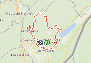
Rando n°1 Les Rousses

dudu79
User

Length
16.1 km

Max alt
1282 m

Uphill gradient
447 m
Km-Effort
22 km

Min alt
1026 m

Downhill gradient
444 m
Boucle
Yes
Creation date :
2024-06-17 05:34:56.658
Updated on :
2024-06-17 05:35:36.394
5h00
Difficulty : Very difficult

FREE GPS app for hiking
 SityTrail
IGN / Geographical institutes
SityTrail Plus
The world is yours!
About
Trail Walking of 16.1 km to be discovered at Bourgogne-Franche-Comté, Jura, Les Rousses. This trail is proposed by dudu79.
Positioning
Country:
France
Region :
Bourgogne-Franche-Comté
Department/Province :
Jura
Municipality :
Les Rousses
Location:
Unknown
Start:(Dec)
Start:(UTM)
274186 ; 5152419 (32T) N.
Comments